
Hobart ZIP Directory Coverage
Official postal and city evidence supports 46342 as Hobart's primary postal anchor. The City parcel layer returned that base value when records were filtered to city HOBART. It also returned a ZIP+4 version and a value with trailing spaces. Those are formatting variants, not extra ZIP areas. Nearby codes appear in a state agency service list, but that list routes clients to an office and does not redraw Hobart's boundary.
| ZIP Code | Areas Covered | Post Office | Notes |
|---|---|---|---|
| 46342 | Primary Hobart postal anchor; city parcel results | Hobart Post Office | Postal area is not the incorporated boundary |
| 46342-4243 | One full ZIP+4 found in city parcel data | Same base postal area | Delivery format, not a separate ZIP |
| 46405 | Nearby agency service routing | Lake Station context | Not verified as a Hobart city ZIP |
| 46410 | Nearby agency service routing | Merrillville context | A sample parcel was in Merrillville |
| 46411 | Nearby agency service routing | Gary context | Not verified as a Hobart city ZIP |
The distinction matters. Indiana FSSA lists 46342, 46405, 46410, and 46411 for its Hobart office service area. That fact explains agency routing only. It cannot support a claim that all four codes lie within the city. The defensible Hobart ZIP code directory puts the verified postal anchor first and clearly labels every nearby code by the source that uses it.
Hobart's 46342 Postal Anchor
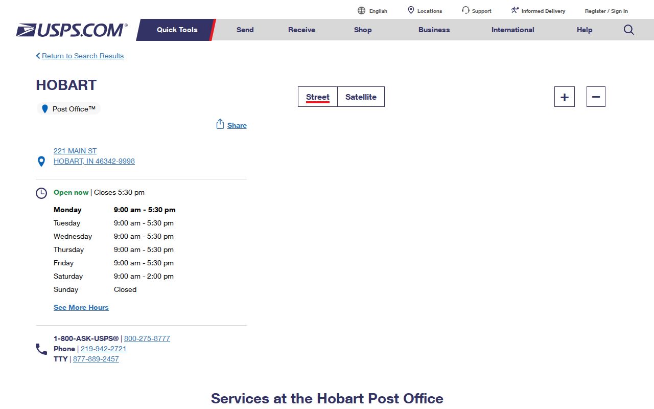
The USPS Hobart location is at 221 Main Street, Hobart, IN 46342-9998. The official listing gives phone 219-942-2721 and hours of 9:00 a.m. to 5:30 p.m. Monday through Friday and 9:00 a.m. to 2:00 p.m. Saturday. USPS is the right authority for post-office details and mail routing. It does not define the City of Hobart's incorporated line.
The official USPS listing anchors the postal side of the lookup.
Clean Hobart ZIP Data First
Hobart parcel data exposes a small but important data quirk. A distinct query returned 46342, 46342-4243, and 46342 with trailing spaces. Count all three as the same base ZIP for grouping. Keep the raw value beside the cleaned value, since the extra four digits or blank spaces explain why two searches may produce different results.
| Raw value | Comparison value | Reason to keep the original |
|---|---|---|
| 46342 | 46342 | Base five-digit postal code |
| 46342 with trailing spaces | 46342 | Shows a source-data cleanup issue |
| 46342-4243 | 46342 plus extension 4243 | Preserves delivery detail |
| 46410 | 46410 | Requires city filtering because the sample was Merrillville |
Do not discard the ZIP+4. It can help confirm an exact mailing record. Just do not treat it as its own neighborhood, city, or five-digit service area.
Find Hobart Residents by ZIP
A postal ZIP is a broad first filter. The useful second test is the authority that owns the data. For current parcels, filter the City FeatureServer to city HOBART and inspect the location ZIP and parcel geometry. For mailing facts, check USPS. For municipal geography, use the city or Census incorporated-place boundary. For election geography, use the dated Lake County precinct maps rather than treating the ZIP as a voting district.
- Confirm the mailing code with USPS and preserve the full ZIP+4 if shown.
- Filter the Hobart parcel layer by both
loccity='HOBART'and the normalized location ZIP. Review each parcel's own ID and situs field. - Compare the parcel geometry with CityBoundary, township, or Census incorporated-place layers when city status matters.
- Use Indiana Voters only to verify a supplied voter's registration. Use dated HO precinct maps for election geography, not as a resident roster.
Once the postal area is narrowed to a named road, the Hobart street directory provides the address-level chain. That handoff prevents a ZIP-wide result from being presented as proof about one household.
Filter Hobart Parcels Two Ways
The City parcel service holds records beyond Hobart, so a ZIP-only filter is unsafe. A Lake County service result at 7725 Clay Appr Street carried city MERRILLVILLE and ZIP 46410. That is useful proof that the service boundary is wider than the city target. A valid Hobart ZIP directory query checks both the city field and location ZIP before interpreting results.
| Field or layer | Search value | What it answers |
|---|---|---|
loccity | HOBART | Source's current city label |
loczipcode | 46342 or raw ZIP+4 | Parcel's location ZIP field |
situs_add | Exact physical address | Parcel location, not tax mailing destination |
| CityBoundary | Parcel geometry | Whether geometry falls in the mapped city line |
| Voting districts | Dated layer or HO map | Election geography for that map date |
Keep the query date and returned spelling. Abbreviations, directionals, and whitespace can change a match even when a person would read the addresses as equivalent.
Hobart ZIPs Are Not Precincts
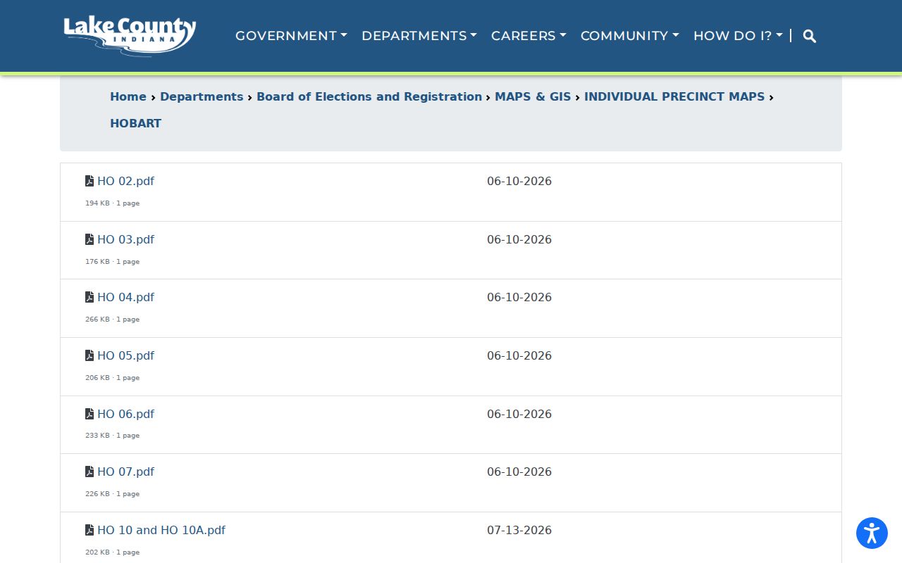
The Lake County Hobart precinct page lists current HO map codes, including HO 02 through HO 29 with gaps, combinations, and dated files. Most inspected entries were dated June 10, 2026, while some showed July 2026. Election lines can change, so save the map date whenever a ZIP-based search crosses into precinct geography.
The official precinct inventory illustrates that separate system.
Place West Hobart Correctly
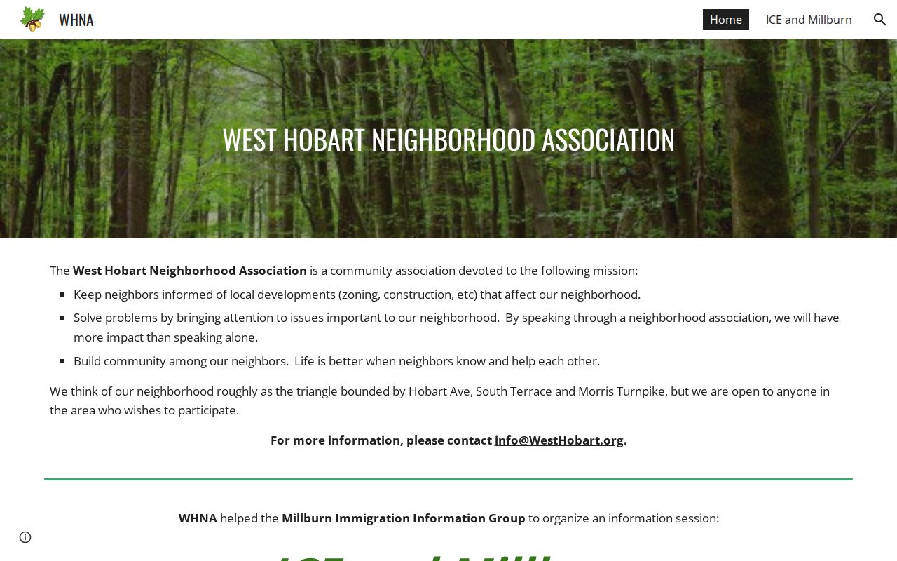
The West Hobart Neighborhood Association describes a rough triangle bounded by Hobart Avenue, South Terrace, and Morris Turnpike. That civic description can orient a postal result, but it is not a legal ZIP boundary or member list. Hobart's sustainable-neighborhood framework separately identifies 74 neighborhood groups and 216 neighborhoods based on parcels, roads, waterways, building stock, access, and other map factors.
The association's public boundary and mission page provides the local context.
Hobart Annexations Change Searches
Today's city label may not fit an older address. Hobart's official history records a north Hobart Township annexation in 1988 and a Ross Township annexation in 1992. A directory, parcel deed, census entry, or map created before those changes may use the township name even when the same place now lies in Hobart. Preserve the historical wording instead of rewriting it to match today's ZIP code directory.
This is also why postal and municipal labels must stay apart. A mail route can keep a familiar city name while an incorporated line, township reference, school district, and precinct answer different questions. Use the date of the record as the pivot.
Note: Search Hobart Township and Ross Township alongside Hobart when an address trail crosses the 1988 or 1992 annexation dates.
Hobart ZIPs Versus City Limits
A Hobart ZIP code search should retain the address exactly as the source displays it. The city parcel sample returned 46342 as the common location ZIP, but the same data also contained ZIP+4 forms and values with extra spaces. Those variants are formatting issues to test, not new postal areas. Search the five-digit form first. If an exact filter misses a known parcel, trim spaces, remove the four-digit extension, and compare the property number before deciding the record is absent.
Other nearby codes require even more care. Indiana service-area material reviewed for Hobart also referenced 46405, 46410, and 46411. A service-area list describes where a program operates; it does not prove that each code belongs inside Hobart. Likewise, a city name printed on mail does not settle incorporation. Postal service, municipal government, township assessment, election precincts, school districts, and Census geography each draw lines for a different purpose.
| Question | Best official source |
|---|---|
| Will this address receive Hobart mail? | USPS address and location tools |
| Is the parcel inside city limits? | Hobart CityBoundary layer or Census place geometry |
| Which owner and parcel ID appear? | Lake County Assessor and Hobart parcel service |
| Which precinct covers the point? | Lake County Elections precinct maps |
That source-by-question method keeps the Hobart ZIP code directory useful without turning a postal label into a claim about residence, ownership, or voting geography.
USPS ZIPs route mail. The CityBoundary layer and Census incorporated-place geometry describe municipal geography. Hobart city FIPS 1834114 identifies the incorporated place in Census sources, while city GIS adds parcel, township, voting-district, and block-group layers. None of those systems can substitute for all the others. A parcel may carry a Hobart mailing address while also having distinct county, township, precinct, and district facts.
Use Census TIGERweb incorporated-place data when the question is whether a point lies within the mapped city. Use USPS for delivery. Ask City GIS or the Assessor about an unresolved parcel, Elections about a precinct, and the record custodian about the historic place name. No official public USPS bulk address-boundary file was found in the research.
- ZIP vs ZIP+4
- A five-digit ZIP is a broad delivery area. ZIP+4 adds a smaller delivery segment.
- PO-box ZIP
- A code assigned mainly to post-office boxes rather than ordinary street delivery.
- Unique ZIP
- A ZIP assigned to one large organization or institution. None was verified for Hobart.
- Carrier route
- A group of delivery points served by a postal carrier, not a city or neighborhood boundary.
Boundary rule. Never label every 46342 address a City of Hobart resident without checking the parcel or incorporated-place boundary.