
Walk a Hobart Street Record
A reliable street-by-street search moves from the physical parcel to named records. Begin with the address exactly as shown on a bill, deed, or old directory. The Lake County assessor search can return the property ID, owner field, address, city, map, detail, and service links. Preserve its spelling. Then use Hobart GIS to check the parcel shape, situs address, and legal description. Situs means the location assigned to the parcel, while the mailing field is where tax mail goes.
- Search the street number and name in the assessor portal. Save the Property ID and exact address.
- Open the city parcel layer. Compare situs, mailing address, ZIP, legal description, acreage, and district fields.
- Use the legal description or plat clue to identify the recorded lot, subdivision, and book or page.
- Follow the current owner into the Recorder search as grantee, then work backward through prior grantors.
- For a dated household clue, consult a directory or census from the same period.
This sequence makes the Hobart street directory useful without overstating what one record proves. A parcel result supports ownership and property facts. A deed supports a recorded transfer. A directory supports a dated published listing. For the volumes themselves, the Hobart city directory collections explain years and shelf access.
Filter Hobart Streets by Parcel
The assessor offers a simple address search and a broad AdvancedSearch screen. The latter can describe the pattern of a Hobart street through property traits. These fields classify parcels for assessment. They do not identify each person in a building, nor do they prove how a structure is used today.
| Search control | Observed choices | Street use |
|---|---|---|
| Address or property number | Text search; no required mark observed | Find one parcel or repeat a street form |
| Sale and value | Sale date, sale price, assessed value | Compare assessment patterns |
| Building | Style, class, year built, area, stories | Sort parcels without inferring residents |
| Place | Neighborhood, district, acreage | Keep city and township contexts distinct |
The captured screen shows how deep those optional filters run.
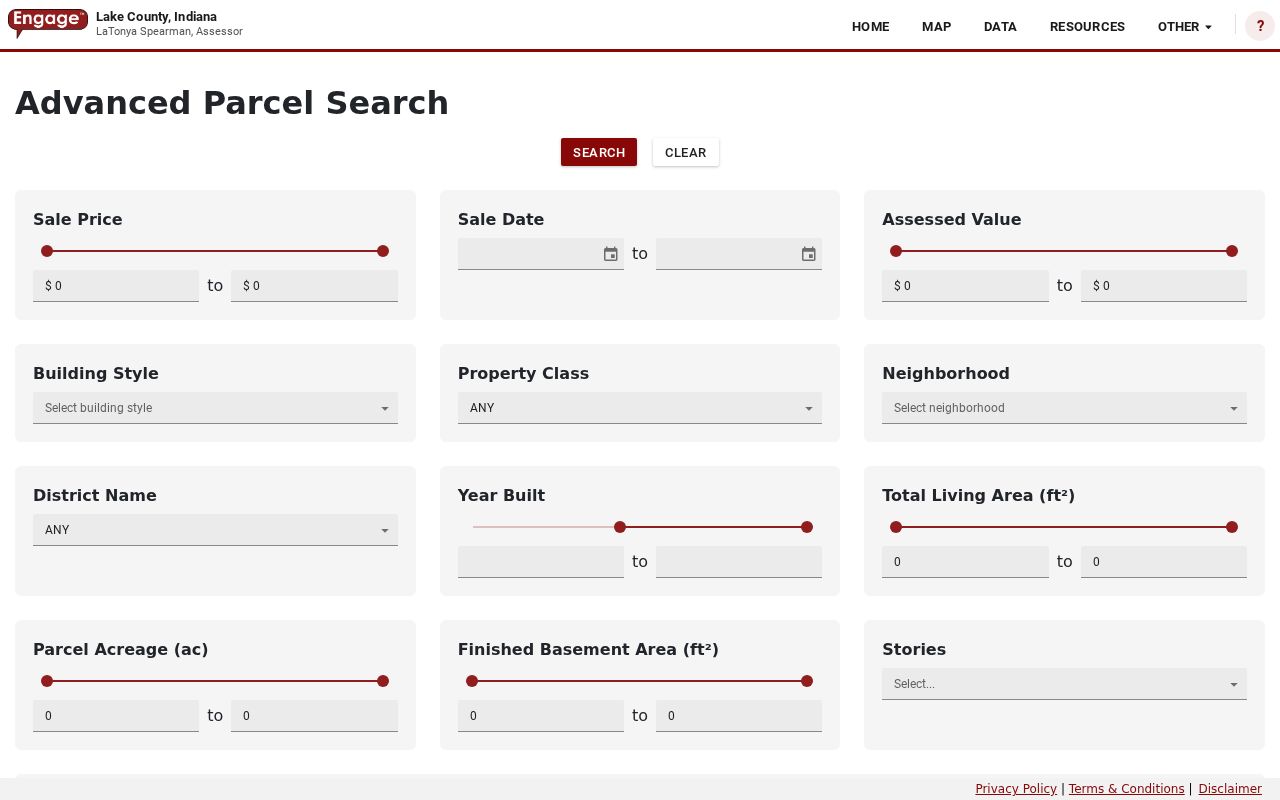
Sale ranges, styles, neighborhood labels, district names, age, floor area, and acreage can narrow a parcel set, but every result still needs an address and property-ID check.
Compare Hobart Street Addresses
Hobart's public parcel layer stores separate location and mailing fields. A parcel at 1260 County Line Road uses a Hobart situs and a mailing line that adds a south directional. The sampled 145 S Delaware Street parcel has matching situs and mailing lines. A county-service sample at 7725 Clay Appr Street has a Merrillville situs and a different mailing address. These examples show why the city, suffix, directional, and parcel geometry all matter.
- Parcel
- A mapped unit of land identified by a property number and legal description.
- Situs address
- The street location assigned to land, distinct from the tax-mail destination.
- Plat
- A recorded map that lays out lots, streets, easements, or a subdivision.
- Criss-cross directory
- A directory arranged by street or phone rather than only surname. No separate Hobart title was verified.
Keep raw and cleaned values. Search both “RD” and “Road,” preserve an unusual form such as “APPR,” and test a directional rather than silently adding it. No complete official house-number conversion table was found.
Hobart Records Indexed by Address
No office keeps a roster of everyone along a Hobart street. Useful records instead attach an owner, filing, map feature, or public action to an address. Each channel has a distinct role.
| Address source | Keeper | What it can show | Access route |
|---|---|---|---|
| Assessment roll | Lake County Assessor | Owner, Property ID, situs, value, traits | DataOnly, AdvancedSearch, office card |
| Parcel and planning layers | Hobart GIS | Geometry, address fields, zoning, plat clues | Public services and city maps |
| Deeds and plats | Lake County Recorder | Parties, instrument, legal description, book/page | Account screen, office, records request |
| Permits and city actions | Building, Engineering, Archive | Construction, right-of-way, zoning, public works | Contact, archive, agendas, APRA |
| Dated directories and maps | Libraries and archives | Published address, owner-map label, building context | Shelf, licensed database, microfilm |
The county tax portal is linked, but its fields were not retrievable during research. Use a parcel number and year range when asking the Treasurer for bills or assessment history.
Bridge Hobart Streets to Plats
A street name may be less stable than its subdivision and recorded plat. Hobart's public subdivision layer exposes a conveyance name, plan number, source reference, page, and plat-book field. Samples include Donato Acres at PB40-004 and Wilson Addition at PB83-025. Those codes are leads for a Recorder request, not certified plats and not proof of who owns a lot.
The layer display shows how map geometry can yield a document clue.
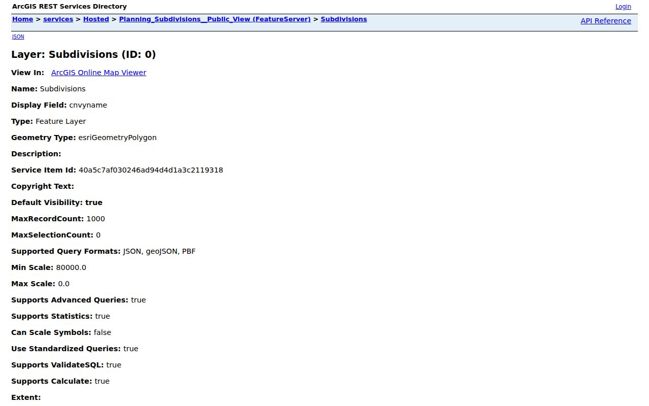
Give the Recorder the subdivision, plan designator, page, parcel number, and document type. This is more useful than asking for a broad history of a whole street.
Follow Hobart Streets Into Deeds
The Lake County Recorder search route redirected to account login and registration controls. Full fields, images, coverage dates, and the first indexed year could not be confirmed. That makes counter and records-request paths essential, especially for an older Hobart street.
Start with the owner, parcel number, legal description, and any book/page value. Search the owner as grantee, the person receiving an interest, then use the matching deed's grantor, the person transferring it, as the next name backward. If the web route blocks the chain, contact the Lake County Recorder at 2293 N Main Street in Crown Point or 219-755-3730. Ask for a defined parcel and date interval. The office holds deeds, mortgages, liens, releases, leases, and plats. Court orders, wills, marriages, and vital records route elsewhere.
Access tip. A blank transfer field in Hobart GIS means no value appeared; it does not prove that no deed exists.
Read Hobart Street Map Layers
The City of Hobart map index links GIS, zoning, FEMA, street, and thoroughfare resources. Hosted services add boundaries, township lines, voting districts, historic and riverfront districts, TIF areas, easements, wetlands, flood zones, and school boundaries. These layers explain context. They do not establish a person's identity or private status.
The official map index appears in the assigned capture.
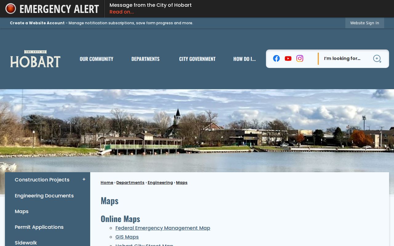
Use the smallest layer that answers the question. Parcel geometry is best for a lot. A city boundary resolves incorporated Hobart. A historic overlay adds planning context, while a precinct map supplies election geography without naming voters.
Search Hobart Street Project Files
Physical changes can explain why an address looks wrong. The Building Department handles construction, remodeling, inspections, contractor licensing, and code complaints. Engineering handles right-of-way, sewer and road permits, as-recorded drawings, and development review. No public address-keyed permit-result search was captured.
Search the City Archive and Agenda Center by exact street, project, and date. Historic Preservation, Plan Commission, zoning appeals, Unsafe Building, redevelopment, Public Works, and Council files may name an applicant or owner. Read the document before tying a name to an address. The archive search supports a keyword, archive category, time period, and start and end dates. Board of Works minutes, ordinances, redevelopment files, police newsletters, and sanitary or stormwater resolutions may preserve the name of a street project when a parcel screen does not.
For a missing file, send the Clerk-Treasurer a reasonably particular APRA request with street segment, record type, department, and date range. The city request route goes to 414 Main Street, Hobart, through records@cityofhobart.org or 219-942-1940. State the exact record sought and whether inspection or copies will work. The researched city form lists a photocopy cost of ten cents per page. APRA opens existing public records, not an uncreated street history, so a request for a named permit, resolution, drawing, or date range is stronger than a request to compile everyone who lived on a street.
Place Hobart Streets in Time
The 1898 Fisher Map of Hobart, Lake County Indiana indicates property owners and is listed by the State Library map guide as ISLZ 912.772 ILaHo98f. University catalogs point to Hobart Sanborn sheets for 1895, 1902, 1910, and 1922. A Sanborn map shows building footprint and use for its date. Neither proves a current resident.
Hobart history records north Hobart Township annexation in 1988 and Ross Township annexation in 1992. An older deed, map, directory, or census may use township wording for land now called Hobart. Preserve that label. Search both place names, and match the legal description or plat before deciding entries refer to the same property.
Note: No official Hobart-wide street-renumbering table was located, so suspected number changes need several dated sources.
Check Dated Hobart Street Listings
The Indiana State Library lists Hobart Polk volumes for 1962, 1972, 1974, 1976, 1981, 1983, 1987, 1989, and 1991. Countywide Polk directories are listed for 2012, 2015, and 2020. Those runs are discontinuous. No official source confirmed a separate Hobart criss-cross title or a street section in every volume.
Ask a librarian to inspect one year and address, identify whether the book is alphabetical, street ordered, or reverse ordered, and report the page and volume. Attach the year to each finding. A missing person may reflect a gap, omission, abbreviation, or move. For the street directory, these volumes are dated support after the parcel and deed fix the physical place.
Other dated sources can test the result without turning the Hobart street directory into a guess. The Indiana State Library newspaper collection provides microfilm, Indiana Legacy indexing, Hoosier State Chronicles, onsite tools, and interlibrary-loan routes. A newspaper item may connect an address to a public sale, civic action, or family event, but the title, date, and page must be checked. The 1950 federal census supplies a public household snapshot for its date. When these sources disagree, keep both dated statements and look for a deed, map, or later directory that resolves the change.
Limits of Hobart Street Records
Property records name owners, not all occupants. Mailing addresses can belong to agents, trusts, or another delivery point. Permit files concern work on land. Voter tools verify registration and polling place from supplied data; they are not a block roster. Protected, sealed, confidential, or unindexed material will remain absent.
A careful Hobart street directory states what each source says and avoids excess personal detail. Use official records for family history, property research, civic inquiry, estate work, or fraud prevention. The city parcel layer includes a confidentiality field, which should be treated as a protection flag rather than a prompt to seek hidden details. Indiana's Address Confidentiality Program also supplies substitute addresses for qualifying participants. If a source carries such a flag or substitute address, stop and respect it.
Lawful use. Use Hobart address records for a lawful personal purpose. Never use them to stalk, harass, threaten, or harm anyone.